
Mapa topográfico 南宁市 / Nanning
Mapa interactivo
Haga clic en el mapa para ver la altitud.
Acerca de este mapa
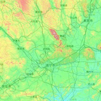
Nombre: Mapa topográfico 南宁市 / Nanning, altitud, relieve.
Lugar: 南宁市 / Nanning, Guangxi, China (22.20440 107.32990 24.03392 109.61326)
Altitud media: 229 m
Altitud mínima: 10 m
Altitud máxima: 1.721 m