
Gracias por apoyar a este sitio ❤️
Haz una donación
Haz una donación
Mapa topográfico Vale
Haga clic en el mapa para ver la altitud.
Gracias por apoyar a este sitio ❤️
Haz una donación
Haz una donación
Acerca de este mapa
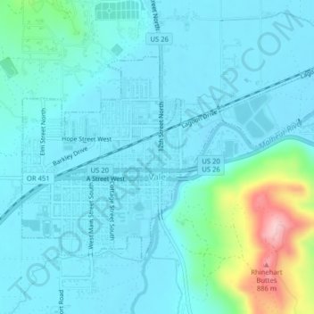
Nombre: Mapa topográfico Vale, altitud, relieve.
Lugar: Vale, Malheur County, Oregón, Estados Unidos de América (43.97467 -117.25552 43.99298 -117.21592)
Altitud media: 710 m
Altitud mínima: 677 m
Altitud máxima: 897 m
Gracias por apoyar a este sitio ❤️
Haz una donación
Haz una donación