Mapa topográfico Aluva
Mapa interactivo
Haga clic en el mapa para ver la altitud.
Acerca de este mapa
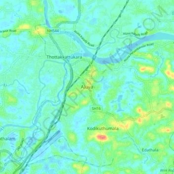
Nombre: Mapa topográfico Aluva, altitud, relieve.
Lugar: Aluva, Ernakulam District, Kerala, 683101, India (10.06041 76.31699 10.14041 76.39699)
Altitud media: 11 m
Altitud mínima: -2 m
Altitud máxima: 52 m
Aluva Railway Station is a major stop for trains that passes north to south of Kerala. It is the third busiest station in Kochi city, after Ernakulam Junction railway station and Ernakulam Town railway station. The station is important for southern railway because of the number of passengers itself. The commuters and travellers from Idukki district have to use either this station or the Tripunithura railway station for all their train journeys as there is no possible railway in the Idukki topography. There are no trains starting or ending at this station, but there are a lot of trains which stop for considerable duration here.
Otros mapas topográficos
Haga clic en un mapa para ver su topografía, su altitud y su relieve.
Uravu Kulam
India > Kerala > Aluva > Vengoor
Uravu Kulam, Laksham veedu Colony marottichodu, Vengoor, Aluva, Ernakulam District, Kerala, India
Altitud media: 15 m
Parunth Ranchi Thuruth
India > Kerala > Aluva > Aluva
Parunth Ranchi Thuruth, Aluva, Ernakulam district, Kerala, India
Altitud media: 9 m
Malayattoor
Malayattoor, Aluva, Ernakulam District, Kerala, 683587, India
Altitud media: 19 m