
Gracias por apoyar a este sitio ❤️
Haz una donación
Haz una donación
Mapa topográfico Monte Aráyat
Haga clic en el mapa para ver la altitud.
Gracias por apoyar a este sitio ❤️
Haz una donación
Haz una donación
Acerca de este mapa
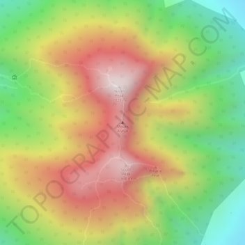
Nombre: Mapa topográfico Monte Aráyat, altitud, relieve.
Lugar: Monte Aráyat, Arayat, Pampanga, Luzón Central, Filipinas (15.20124 120.74306 15.20134 120.74316)
Altitud media: 639 m
Altitud mínima: 246 m
Altitud máxima: 995 m
Gracias por apoyar a este sitio ❤️
Haz una donación
Haz una donación