
Mapa topográfico Cantón
Mapa interactivo
Haga clic en el mapa para ver la altitud.
Acerca de este mapa
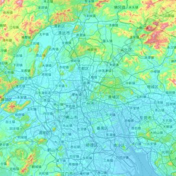
Nombre: Mapa topográfico Cantón, altitud, relieve.
Lugar: Cantón, Provincia de Cantón, China (22.56080 112.95237 23.93599 114.05530)
Altitud media: 98 m
Altitud mínima: -10 m
Altitud máxima: 1.236 m
Otros mapas topográficos
Haga clic en un mapa para ver su topografía, su altitud y su relieve.