
Mapa topográfico Whitesburg
Mapa interactivo
Haga clic en el mapa para ver la altitud.
Acerca de este mapa
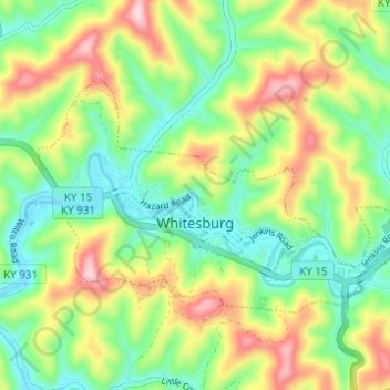
Nombre: Mapa topográfico Whitesburg, altitud, relieve.
Lugar: Whitesburg, Letcher County, Kentucky, United States (37.10708 -82.85159 37.13676 -82.78998)
Altitud media: 446 m
Altitud mínima: 338 m
Altitud máxima: 620 m
Otros mapas topográficos
Haga clic en un mapa para ver su topografía, su altitud y su relieve.
Eolia
United States > Kentucky > Letcher County
Eolia, Letcher County, Kentucky, 40826, United States
Altitud media: 612 m