
Mapa topográfico Erzurum
Mapa interactivo
Haga clic en el mapa para ver la altitud.
Acerca de este mapa
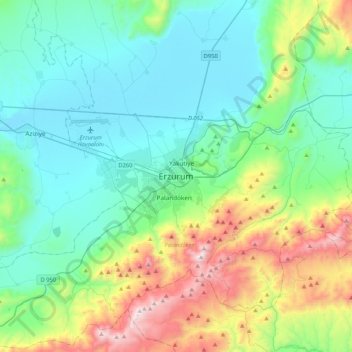
Nombre: Mapa topográfico Erzurum, altitud, relieve.
Altitud media: 2.089 m
Altitud mínima: 1.750 m
Altitud máxima: 3.166 m
Six kilometres to the south of the center of Erzurum is an important skiing center on the Palandöken Mountain range. There are several ski runs; the south ski run is eight km long, while the north ski run is intended for advanced skiers. The summit of Mt. Palandöken, which is called Büyük Ejder (Great Dragon), is at an altitude of 3188 metres. It can be reached with a chairlift which rises to an altitude of 3100 metres.