Mapa topográfico The Glens of Antrim
Mapa interactivo
Haga clic en el mapa para ver la altitud.
Acerca de este mapa
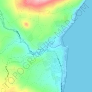
Nombre: Mapa topográfico The Glens of Antrim, altitud, relieve.
Altitud media: 44 m
Altitud mínima: -1 m
Altitud máxima: 174 m

Haga clic en el mapa para ver la altitud.
Nombre: Mapa topográfico The Glens of Antrim, altitud, relieve.
Altitud media: 44 m
Altitud mínima: -1 m
Altitud máxima: 174 m