
Mapa topográfico Wetaskiwin
Mapa interactivo
Haga clic en el mapa para ver la altitud.
Wetaskiwin
The city lies at an elevation of 760 m (2,490 ft). Coal Lake, a reservoir developed on the Battle River is located immediately east of the city, and other nearby waterways include Pipestone Creek, Bigstone Creek, Bittern Lake and Bearhills Lake.
Acerca de este mapa
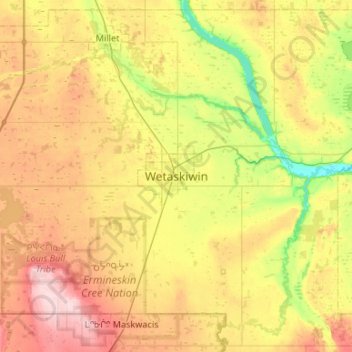
Nombre: Mapa topográfico Wetaskiwin, altitud, relieve.
Lugar: Wetaskiwin, City of Wetaskiwin, Alberta, T9A 0T5, Canada (52.80849 -113.52792 53.12849 -113.20792)
Altitud media: 770 m
Altitud mínima: 693 m
Altitud máxima: 867 m