
Mapa topográfico Miller Water Table
Mapa interactivo
Haga clic en el mapa para ver la altitud.
Acerca de este mapa
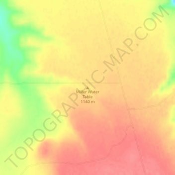
Nombre: Mapa topográfico Miller Water Table, altitud, relieve.
Lugar: Miller Water Table, Owyhee County, Idaho, United States (42.65013 -115.73652 42.65023 -115.73642)
Altitud media: 1.140 m
Altitud mínima: 1.094 m
Altitud máxima: 1.159 m
Otros mapas topográficos
Haga clic en un mapa para ver su topografía, su altitud y su relieve.
Homedale
United States > Idaho > Owyhee County
Homedale, Owyhee County, Idaho, 83628, United States
Altitud media: 683 m
Marsing
United States > Idaho > Owyhee County
Marsing, Owyhee County, Idaho, United States
Altitud media: 694 m
Sinker Butte
United States > Idaho > Owyhee County
Sinker Butte, Owyhee County, Idaho, United States
Altitud media: 892 m
Grand View
United States > Idaho > Owyhee County
Grand View, Owyhee County, Idaho, United States
Altitud media: 737 m