
Mapa topográfico Putnam Hall
Haga clic en el mapa para ver la altitud.
Acerca de este mapa
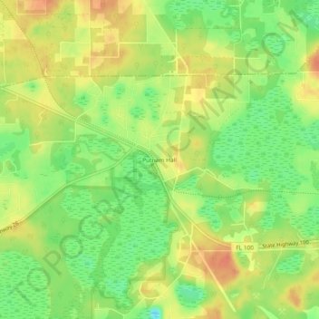
Nombre: Mapa topográfico Putnam Hall, altitud, relieve.
Lugar: Putnam Hall, Putnam County, Florida, 32185, United States (29.71663 -81.97926 29.75663 -81.93926)
Altitud media: 34 m
Altitud mínima: 10 m
Altitud máxima: 54 m
Otros mapas topográficos
Haga clic en un mapa para ver su topografía, su altitud y su relieve.
Palatka
United States > Florida > Putnam County
Palatka is located at 29°38′N 81°39′W / 29.633°N 81.650°W / 29.633; -81.650. The total area is 7.5 square miles (19 km2) and has an average elevation of 16 feet (4.8 m) above sea level. The city is located in the southern portion of the Lower St. Johns River basin.
Altitud media: 8 m