
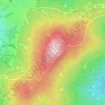
Mapa topográfico Großer Feldberg
Mapa interactivo
Haga clic en el mapa para ver la altitud.
Großer Feldberg
The Großer Feldberg ("Great Field Mountain") is, at a height of 879.5 metres, the highest elevation of the Taunus mountains, and of the entire Rhenish Massif. It is situated in the Hochtaunuskreis district in Hesse, Germany.
Acerca de este mapa
Nombre: Mapa topográfico Großer Feldberg, altitud, relieve.
Altitud media: 716 m
Altitud mínima: 549 m
Altitud máxima: 884 m