
Haz una donación
Mapa topográfico Chickahominy Mountain
Haga clic en el mapa para ver la altitud.
Haz una donación
Acerca de este mapa
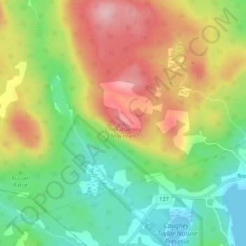
Nombre: Mapa topográfico Chickahominy Mountain, altitud, relieve.
Altitud media: 87 m
Altitud mínima: -8 m
Altitud máxima: 191 m
Haz una donación
Otros mapas topográficos
Haga clic en un mapa para ver su topografía, su altitud y su relieve.
Fredericton
Canada > New Brunswick > Kingsclear Parish > Fredericton
At an altitude of about 17 m (56 ft) above sea level, Fredericton is nestled in the Pennsylvanian Basin. It differs markedly from the geologically older parts of the province. There are prominently two distinct areas in the region that are divided around the area of Wilsey Road, in the east end of the city. In…
Altitud media: 72 m
City of Fredericton
At an altitude of about 17 m (56 ft) above sea level, Fredericton is nestled in the Pennsylvanian Basin. It differs markedly from the geologically older parts of the province. There are prominently two distinct areas in the region that are divided around the area of Wilsey Road, in the east end of the city. In…
Altitud media: 71 m
Haz una donación
City of Saint John
Canada > New Brunswick > Saint John County
The topography surrounding Saint John is hilly; a result of the influence of two coastal mountain ranges which run along the Bay of Fundy – the St. Croix Highlands and the Caledonia Highlands. The soil throughout the region is extremely rocky with frequent granite outcrops. The coastal plain hosts numerous…
Altitud media: 37 m
Haz una donación
Haz una donación
Fundy National Park of Canada
Canada > New Brunswick > Fundy Albert > Alma Parish
According to the Commission for Environmental Cooperation, the park is located in the Level III- Eastern Temperate Forests (Maine-New Brunswick Plains and Hills) ecoregion. According to the Ecological Framework of Canada, the park is situated in two distinct ecoregions. The southern section of the park falls…
Altitud media: 230 m
Haz una donación
Haz una donación
Haz una donación
Haz una donación
Haz una donación
Haz una donación
Haz una donación
Haz una donación
Haz una donación
Haz una donación
Haz una donación
Haz una donación
Haz una donación
Northwest Miramachi River
Canada > New Brunswick > Greater Miramichi Rural District
Altitud media: 214 m
Campobello Island
Canada > New Brunswick > Rural Community of Campobello Island > Campobello Parish
Altitud media: 6 m
Haz una donación
Edmundston
Canada > New Brunswick > Edmundston
Edmundston has a downhill skiing facility in the city at Mont Farlagne. This facility has 3 lifts, a t-bar, a double chair, and a quad chair. It has 14 trails and an elevation of 690 feet. Snowmaking is available. Five trails are lit for night skiing.
Altitud media: 256 m
Haz una donación
Fredericton
Canada > New Brunswick > City of Fredericton
At an altitude of about 17 m (56 ft) above sea level, Fredericton is nestled in the Pennsylvanian Basin. It differs markedly from the geologically older parts of the province. There are prominently two distinct areas in the region that are divided around the area of Wilsey Road, in the east end of the city. In…
Altitud media: 69 m
Haz una donación
Haz una donación
Haz una donación
Haz una donación
Grand Manan Island
Canada > New Brunswick > Village of Grand Manan > Grand Manan Parish
Altitud media: 17 m
Saint-Quentin
Canada > New Brunswick > Saint Quentin Parish
Saint-Quentin is in the Restigouche region of the Appalachian Mountains, 50 kilometres west of Mount Carleton, the province's highest elevation.
Altitud media: 284 m
Haz una donación
Haz una donación
Haz una donación