
Haz una donación
Mapa topográfico Bonnet Hill
Haga clic en el mapa para ver la altitud.
Haz una donación
Acerca de este mapa
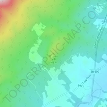
Nombre: Mapa topográfico Bonnet Hill, altitud, relieve.
Lugar: Bonnet Hill, Shenandoah County, Virginia, United States (39.01478 -78.50673 39.01488 -78.50663)
Altitud media: 391 m
Altitud mínima: 298 m
Altitud máxima: 667 m
Haz una donación
Otros mapas topográficos
Haga clic en un mapa para ver su topografía, su altitud y su relieve.
Strasburg
United States > Virginia > Shenandoah County
According to the United States Census Bureau, the town has a total area of 3.2 square miles (8.2 km2), of which, 3.2 square miles (8.2 km2) of it is land and 0.04 square miles (0.1 km2) of it (0.63%) is water. The elevation of the area is 578 ft (176 m).
Altitud media: 195 m
Haz una donación