
Mapa topográfico Scrabo Tower
Mapa interactivo
Haga clic en el mapa para ver la altitud.
Acerca de este mapa
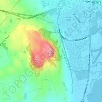
Nombre: Mapa topográfico Scrabo Tower, altitud, relieve.
Altitud media: 39 m
Altitud mínima: -1 m
Altitud máxima: 159 m
The tower's style is called Scottish Baronial by most recent authors.: "... mysteriously designed in the Scottish baronial style ..." The article in the Illustrated London News of 1857 says "... in the style of a Scottish chateau ...", whereas the article in the Dublin Builder of 1865 calls it "Scotch baronial". Its height is 135 feet (41 m) as can be confirmed by measuring the scaled elevation drawing in Howley (1993). However, heights of 125 feet and 195 feet have been given.