
Haz una donación
Mapa topográfico Parlier
Haga clic en el mapa para ver la altitud.
Haz una donación
Parlier
Parlier is a city in Fresno County, California, United States. As of the 2020 census, the city had a total population of 14,576, up from 14,494 in 2010. The city has one of the state's highest percentage of Latinos, a large majority of whom are seasonal migrant laborers who arrive and temporarily work in the area's agricultural sector. Parlier is located 5.5 miles (9 km) east-northeast of Selma, at an elevation of 344 feet (105 m).
Haz una donación
Acerca de este mapa
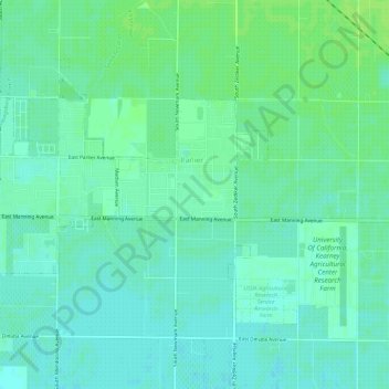
Nombre: Mapa topográfico Parlier, altitud, relieve.
Lugar: Parlier, Fresno County, California, 93648, United States (36.59289 -119.57489 36.62242 -119.51641)
Altitud media: 104 m
Altitud mínima: 97 m
Altitud máxima: 109 m
Haz una donación
Otros mapas topográficos
Haga clic en un mapa para ver su topografía, su altitud y su relieve.
Shaver Lake
United States > California > Fresno County > Shaver Lake
Shaver Lake (formerly, Musick Creek and Musick Creek Heights) is a census-designated place (CDP) in Fresno County, California, United States. The population was 634 at the 2010 census, down from 705 at the 2000 census. Shaver Lake is on the southwest end of the lake of the same name, 10 miles (16 km) east of…
Altitud media: 1.437 m
Haz una donación
Haz una donación
Haz una donación
Yokuts Valley
United States > California > Fresno County
As of the 2010 census, the CDP had a total population of 3,162, up from 2,691 at the 2000 census. For statistical purposes, the United States Census Bureau defined Squaw Valley as a census-designated place (CDP). Yokuts Valley is located 9 miles (14 km) north-northeast of Orange Cove and 30 miles (48 km) east…
Altitud media: 550 m
Haz una donación
Reedley
United States > California > Fresno County
Reedley is a city in Fresno County, California, United States. It is located in the San Joaquin Valley, 22 miles (35 km) east-southeast of Fresno, at an elevation of 348 feet (106 m). The population at the 2010 census was 24,194. Its chief economic source is agriculture, particularly fruit and vegetable…
Altitud media: 106 m
Piedra
United States > California > Fresno County
Piedra (Spanish for "Stone") is an unincorporated community in Fresno County, California. It is located on the south bank of the Kings River 23 miles (37 km) east of Fresno, at an elevation of 538 feet (164 m).
Altitud media: 263 m
Haz una donación
Haz una donación
Charlotte Lake
United States > California > Fresno County
Charlotte Lake (also known as Charlotta Lake, or Rhoda Lake) is a lake in the Sierra Nevada, located in Kings Canyon National Park, eastern Fresno County, California. The lake is located on the John Muir Trail, at an elevation of 10,544 feet (3,214 m).
Altitud media: 3.332 m
Friant
United States > California > Fresno County > Friant
Friant (formerly, Converse Ferry, Jones Ferry, Hamptonville, and Pollasky) is a census-designated place (CDP) in Fresno County, California, United States. The population was 549 at the 2010 census, down from 778 at the 2000 census. Friant is located 11.5 miles (19 km) north of Clovis, at an elevation of 344…
Altitud media: 135 m
Haz una donación
Shaver Lake
United States > California > Fresno County > Shaver Lake
Shaver Lake (formerly Musick Creek and Musick Creek Heights) is a census-designated place (CDP) in Fresno County, California, United States. The population was 580 at the 2020 census, down from 634 at the 2010 census. Shaver Lake is on the southwest end of the lake of the same name, 10 miles (16 km) east of…
Altitud media: 1.437 m
Haz una donación
Haz una donación
Haz una donación