
Mapa topográfico Oliktok Point
Mapa interactivo
Haga clic en el mapa para ver la altitud.
Acerca de este mapa
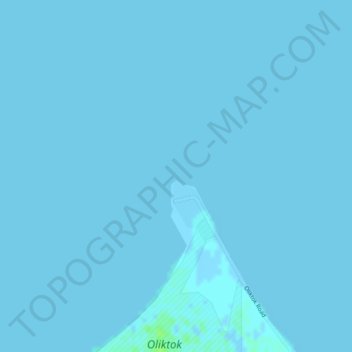
Nombre: Mapa topográfico Oliktok Point, altitud, relieve.
Lugar: Oliktok Point, North Slope, Alaska, United States (70.51297 -149.87064 70.51307 -149.87054)
Altitud media: 0 m
Altitud mínima: -2 m
Altitud máxima: 7 m
Otros mapas topográficos
Haga clic en un mapa para ver su topografía, su altitud y su relieve.
Footprint Lake
United States > Alaska > North Slope > Utqiaġvik
Footprint Lake, Utqiaġvik, North Slope, Alaska, United States
Altitud media: 8 m
Point Barrow
United States > Alaska > North Slope
Point Barrow, North Slope, Alaska, United States
Altitud media: 0 m
Thunder Creek
United States > Alaska > North Slope
Thunder Creek, North Slope, Alaska, United States
Altitud media: 731 m
Wainwright
United States > Alaska > North Slope > Wainwright
Wainwright, North Slope, Alaska, 99782, United States
Altitud media: 3 m
Howe Island
United States > Alaska > North Slope
Howe Island, North Slope, Alaska, United States
Altitud media: 0 m