
Mapa topográfico Stevens Point
Mapa interactivo
Haga clic en el mapa para ver la altitud.
Acerca de este mapa
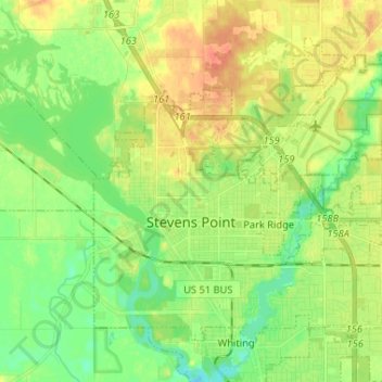
Nombre: Mapa topográfico Stevens Point, altitud, relieve.
Lugar: Stevens Point, Portage County, Wisconsin, United States (44.49296 -89.60731 44.56752 -89.47731)
Altitud media: 335 m
Altitud mínima: 318 m
Altitud máxima: 353 m
Otros mapas topográficos
Haga clic en un mapa para ver su topografía, su altitud y su relieve.
Stevens Point
United States > Wisconsin > Portage County > Stevens Point
Stevens Point, Portage County, Wisconsin, 54881, United States
Altitud media: 341 m