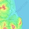
Mapa topográfico County Mayo
Haga clic en el mapa para ver la altitud.
Acerca de este mapa

Nombre: Mapa topográfico County Mayo, altitud, relieve.
Lugar: County Mayo, Connacht, Ireland (53.47193 -10.32256 54.34542 -8.58283)
Altitud media: 66 m
Altitud mínima: -2 m
Altitud máxima: 765 m
Otros mapas topográficos
Haga clic en un mapa para ver su topografía, su altitud y su relieve.

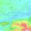








Greystones
Greystones is located south of the site of an ancient castle of the Barony of Rathdown. There was a hamlet which, like Rathdown Castle, was known as Rathdown, and which appeared on a 1712 map. This site occupied an area now known as the Grove, north of Greystones harbour, but only the ruins of a chapel, St.…
Altitud media: 49 m