
Mapa topográfico Sandhill
Mapa interactivo
Haga clic en el mapa para ver la altitud.
Acerca de este mapa
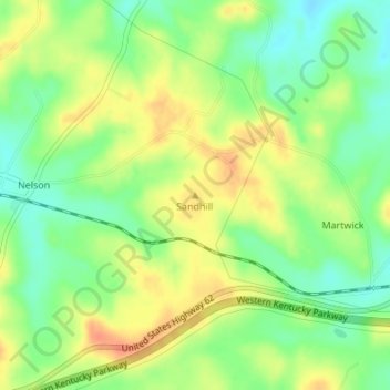
Nombre: Mapa topográfico Sandhill, altitud, relieve.
Lugar: Sandhill, Muhlenberg County, Kentucky, 42369, United States (37.32899 -87.03686 37.32909 -87.03676)
Altitud media: 143 m
Altitud mínima: 121 m
Altitud máxima: 164 m
Otros mapas topográficos
Haga clic en un mapa para ver su topografía, su altitud y su relieve.
Dunmor
United States > Kentucky > Muhlenberg County
Dunmor, Muhlenberg County, Kentucky, 42339, United States
Altitud media: 179 m