
Mapa topográfico Scothern
Haga clic en el mapa para ver la altitud.
Acerca de este mapa
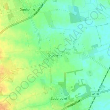
Nombre: Mapa topográfico Scothern, altitud, relieve.
Altitud media: 16 m
Altitud mínima: 5 m
Altitud máxima: 32 m
Otros mapas topográficos
Haga clic en un mapa para ver su topografía, su altitud y su relieve.
Welton CP
United Kingdom > England > Lincolnshire > West Lindsey
The parish stretches from the ancient Ermine Street (A15) in the west, following a north-easterly shape to the Barlings Eau at its eastern end, of which the Welton Beck is a tributary, and is an example of a strip parish. Due to the low, flat topography of Lincolnshire, land had to be drained for agriculture…
Altitud media: 27 m
North Willingham CP
United Kingdom > England > Lincolnshire > West Lindsey > North Willingham CP
Altitud media: 82 m
Corringham CP
United Kingdom > England > Lincolnshire > West Lindsey > Corringham CP
Altitud media: 21 m