
Mapa topográfico Eje Neovolcánico
Mapa interactivo
Haga clic en el mapa para ver la altitud.
Acerca de este mapa
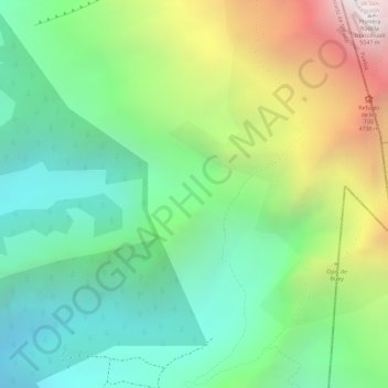
Nombre: Mapa topográfico Eje Neovolcánico, altitud, relieve.
Lugar: Eje Neovolcánico, Amecameca, State of Mexico, Mexico (19.14995 -98.65005 19.15005 -98.64995)
Altitud media: 4.179 m
Altitud mínima: 3.679 m
Altitud máxima: 5.038 m
Volcanic ash make soils in the region very fertile, which (especially coupled with elevation making tropical climate milder) has led to high human population densities in the belt that now sometimes strain the environment.