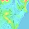
Mapa topográfico Harrington Park
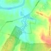
Haga clic en el mapa para ver la altitud.
Acerca de este mapa

Nombre: Mapa topográfico Harrington Park, altitud, relieve.
Lugar: Harrington Park, Sydney, New South Wales, Australia (-34.03933 150.70930 -34.01181 150.76106)
Altitud media: 91 m
Altitud mínima: 62 m
Altitud máxima: 149 m
Otros mapas topográficos
Haga clic en un mapa para ver su topografía, su altitud y su relieve.


St Leonards Park
Australia > New South Wales > Sydney > North Sydney
In 2018 it was announced that North Sydney Council would commence an upgrade of the park including improving the war memorial with a reflection pool, restoration of the Tunks Fountain and elevation on a new plinth, new benches, picnic tables, barbecues and drinking fountains, upgrades to lighting, additional…
Altitud media: 61 m
























Bents Basin State Conservation Area
Australia > New South Wales > Sydney
The park is popular for swimming, kayaking, bushwalking, camping (with 100 tent sites), barbecuing, picnicking and fishing. The park also features walking trails within a bushland and an education centre with a commercial kitchen. Caley's Lookout Track, a walking track within the bushland, leads to Little…
Altitud media: 82 m