

Mapa topográfico Dandenong Ranges
Haga clic en el mapa para ver la altitud.
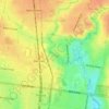
Dandenong Ranges
The topography consists of a series of ridges dissected by deeply cut streams. Sheltered gullies in the south of the range are home to temperate rain forest, fern gullies and Mountain Ash forest Eucalyptus regnans, whereas the drier ridges and exposed northern slopes are covered by dry sclerophyll forest of stringybarks and box. The entire range is highly prone to bushfires, the most recent of which have been the 1983 Ash Wednesday bushfires, the 1997 Dandenong Ranges bushfires and small fires during the Black Saturday bushfires in 2009.
Acerca de este mapa

Nombre: Mapa topográfico Dandenong Ranges, altitud, relieve.
Lugar: Dandenong Ranges, Melbourne, Victoria, 3767, Australia (-37.83532 145.35890 -37.83522 145.35900)
Altitud media: 456 m
Altitud mínima: 213 m
Altitud máxima: 621 m
Otros mapas topográficos
Haga clic en un mapa para ver su topografía, su altitud y su relieve.


St Andrews Beach
Australia > Victoria > Melbourne
St Andrews Beach features a unique topography known as The Cups Country, which creates an ideal environment for golf courses. Golfers have a choice of several nearby golf courses including the St Andrews Beach Club on Sandy Road, Moonah Links off Truemans Road, and The Dunes on Browns Road.
Altitud media: 10 m



Camberwell
Australia > Victoria > Melbourne
The Prospect Hill Road Precinct area is adjacent to the railway station and is the oldest part of the suburb. The original subdivision was relatively generous blocks, which were quickly filled with fine Victorian and Edwardian houses. Due to its hilly topography, many east–west streets in the Prospect Hill…
Altitud media: 66 m










Gilbertsons Grassland Nature Conservation Reserve
Australia > Victoria > Melbourne
Altitud media: 36 m






Fitzroy
Australia > Victoria > Melbourne
Fitzroy's topography is flat. It is laid out in grid plan and is characterised by a fairly tightly spaced rectangular grid of medium-sized streets, with many of its narrow streets and back lanes facilitating only one-way traffic. Its built form is a legacy of its early history when a mixture of land uses was…
Altitud media: 35 m














Vermont South
Australia > Victoria > Melbourne
In 1966 the Metropolitan & Melbourne Board of Works (MMBW) put forth a plan to construct numerous "package" sewage treatment plants in the valleys of Dandenong Creek and its tributaries. The project aimed to provide adequate sewerage to the catchment before the Dandenong Valley Trunk sewer (DVT) could…
Altitud media: 100 m


