
Mapa topográfico Eno River State Park
Mapa interactivo
Haga clic en el mapa para ver la altitud.
Acerca de este mapa
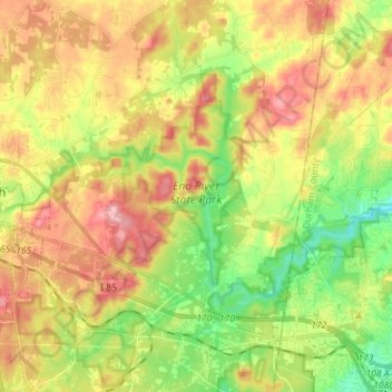
Nombre: Mapa topográfico Eno River State Park, altitud, relieve.
Altitud media: 167 m
Altitud mínima: 100 m
Altitud máxima: 238 m
The Cox Mountain Trail is marked by blue blazes. The 3.75-mile (6.04 km) trail passes a picnic area and crosses the suspension foot bridge. The trail goes up 270 feet (82 m) in elevation and at one point follows Hillsborough Coach Road. When getting closer to Cox Mountain, the trail can get fairly steep. The trail connects to Fanny's Ford trail.
Otros mapas topográficos
Haga clic en un mapa para ver su topografía, su altitud y su relieve.
Efland
United States > North Carolina > Orange County
Efland, Orange County, North Carolina, 27243, United States
Altitud media: 193 m