
Haz una donación
Mapa topográfico Altus
Haga clic en el mapa para ver la altitud.
Haz una donación
Altus
Altus had its start in 1875 when the railroad was extended to that point. Altus station was the highest point on the track. In recognition of this highest railroad elevation between Little Rock and Fort Smith, the station was originally known as "Summit". The town's initial development was due to railroad efforts encouraging German immigration to settle lands adjacent to the railroad. In 1903, the railroad mainline was shifted to a more favorable alignment along the Arkansas River. The track through Altus was removed in the 1930s, but the railroad station has been preserved as a commercial establishment.
Haz una donación
Acerca de este mapa
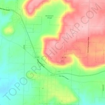
Nombre: Mapa topográfico Altus, altitud, relieve.
Lugar: Altus, Franklin County, Arkansas, 72821, United States (35.43244 -93.78921 35.48086 -93.74796)
Altitud media: 192 m
Altitud mínima: 112 m
Altitud máxima: 278 m
Haz una donación