
Mapa topográfico Worland
Mapa interactivo
Haga clic en el mapa para ver la altitud.
Worland
Worland experiences an arid climate (Köppen BWk), but one which is quite distinct from much of the state. Due to the location within the Big Horn Basin, it is protected from severe weather by the surrounding mountains from nearly every direction. This topography results in weather that is highly continental with frigid and dry winters, little rainfall and few storms.
Acerca de este mapa
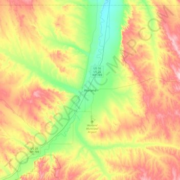
Nombre: Mapa topográfico Worland, altitud, relieve.
Lugar: Worland, Washakie County, Wyoming, 82401, United States (43.85685 -108.11577 44.17685 -107.79577)
Altitud media: 1.319 m
Altitud mínima: 1.203 m
Altitud máxima: 1.461 m