
Mapa topográfico Wild Cattle Island National Park
Mapa interactivo
Haga clic en el mapa para ver la altitud.
Acerca de este mapa
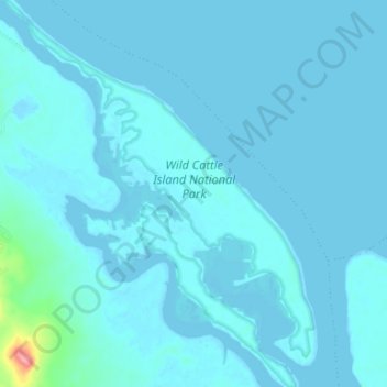
Nombre: Mapa topográfico Wild Cattle Island National Park, altitud, relieve.
Altitud media: 6 m
Altitud mínima: -1 m
Altitud máxima: 101 m
Otros mapas topográficos
Haga clic en un mapa para ver su topografía, su altitud y su relieve.
Tannum Sands
Australia > Queensland > Tannum Sands
Tannum Sands, Gladstone Regional, Queensland, Australia
Altitud media: 9 m