
Gracias por apoyar a este sitio ❤️
Haz una donación
Haz una donación
Mapa topográfico Ramah
Haga clic en el mapa para ver la altitud.
Gracias por apoyar a este sitio ❤️
Haz una donación
Haz una donación
Ramah
Lying at 6926 feet above sea level, Ramah is considered by some as a high desert, but at higher elevations in includes tall pines, sandstone cliffs, and timber covered mountains. Much of the lower landscape in the surrounding area is covered with lava flows from the chain of volcanos to the south. Intermixed in the scenery are ruins of an ancient people who dotted the land.
Gracias por apoyar a este sitio ❤️
Haz una donación
Haz una donación
Acerca de este mapa
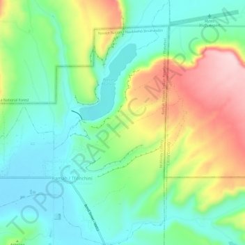
Nombre: Mapa topográfico Ramah, altitud, relieve.
Lugar: Ramah, McKinley County, New Mexico, United States (35.12004 -108.51534 35.16785 -108.46848)
Altitud media: 2.184 m
Altitud mínima: 2.095 m
Altitud máxima: 2.354 m
Gracias por apoyar a este sitio ❤️
Haz una donación
Haz una donación