
Mapa topográfico Lhoka
Mapa interactivo
Haga clic en el mapa para ver la altitud.
Acerca de este mapa
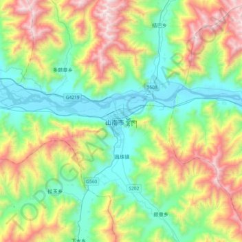
Nombre: Mapa topográfico Lhoka, altitud, relieve.
Lugar: Lhoka, Tsetang Township, Nêdong District, Lhoka, Tibet, China (29.07909 91.61057 29.39909 91.93057)
Altitud media: 4.148 m
Altitud mínima: 3.542 m
Altitud máxima: 5.430 m
Shannan has 1 district and 11 counties and its capital is Tsetang, which is located 183 kilometres from Lhasa. It covers an area of 79,700 square kilometres (30,800 sq mi), which includes part of South Tibet, a disputed territory currently under control of the Indian state of Arunachal Pradesh. Its topography averages 3,700 metres (12,100 ft) above sea level. The population of Tsetang city was 330,100 as of 2007 with Tibetans accounting for 96% of the total population.