
Mapa topográfico The Quill
Mapa interactivo
Haga clic en el mapa para ver la altitud.
Acerca de este mapa
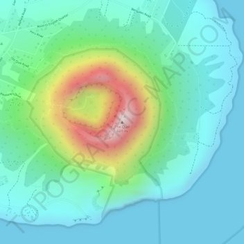
Nombre: Mapa topográfico The Quill, altitud, relieve.
Lugar: The Quill, Oranjestad, Sint Eustatius, Niederlande (17.47613 -62.95999 17.47623 -62.95989)
Altitud media: 143 m
Altitud mínima: 0 m
Altitud máxima: 559 m