
Haz una donación
Mapa topográfico Palo Verde
Haga clic en el mapa para ver la altitud.
Haz una donación
Acerca de este mapa
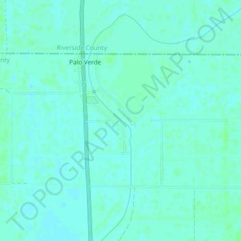
Nombre: Mapa topográfico Palo Verde, altitud, relieve.
Altitud media: 71 m
Altitud mínima: 68 m
Altitud máxima: 74 m
Haz una donación
Otros mapas topográficos
Haga clic en un mapa para ver su topografía, su altitud y su relieve.
Felicity
United States > California > Imperial County
Felicity is an unincorporated community in Imperial County, California. The town was established in 1986 by Jacques-Andre Istel who bought the land in the 1950s and developed it in the 1980s after selling off his parachute business. The town is "Dedicated to Remembrance" and named for Istel's wife Felicia. It…
Altitud media: 89 m
Haz una donación
Haz una donación
Dixieland
United States > California > Imperial County
Dixieland is an unincorporated community in Imperial County, California. The name was likely a reference to the Pima cotton fields in the area. It is located 5 miles (8 km) east of Plaster City on County Route S80, at an elevation of 36 feet (11 m) below sea level.
Altitud media: -3 m
Haz una donación
Tumco
United States > California > Imperial County
Hedges, later renamed Tumco, is a locale, a ghost town, site of a former mining town, in Imperial County, California. It lies at an elevation of 617 feet / 188 meters along the Tumco Wash in the Cargo Muchacho Mountains. Nearby is the Hedges Cemetery at an elevation of 643 feet (196 meters), at 32°53′04″N…
Altitud media: 201 m
Salton City
United States > California > Imperial County
In the 1970s, most of the buildings constructed along the shoreline, including the city's marina were abandoned due to rising sea elevation. In the 1980s, the Imperial Irrigation District took proactive water conservation measures to reduce the flow of unused canal water into the Salton Sea. Throughout the…
Altitud media: -40 m
Haz una donación
Seeley
United States > California > Imperial County
NAF El Centro, the winter home of the Blue Angels, was built adjacent to Seeley in 1946. In 1964, Interstate 8 was run a mile south of Seeley, marking the lowest elevation on the Interstate Highway System at -52 feet.
Altitud media: -12 m
Haz una donación
Haz una donación
Haz una donación
Haz una donación