
Haz una donación
Mapa topográfico Chowchilla
Haga clic en el mapa para ver la altitud.
Haz una donación
Chowchilla
Chowchilla is a city in Madera County, California, United States. The city's population was 19,039 at the 2020 census. Chowchilla is located 16 miles (26 km) northwest of Madera, at an elevation of 240 feet (73 m).
Haz una donación
Acerca de este mapa
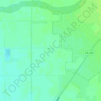
Nombre: Mapa topográfico Chowchilla, altitud, relieve.
Lugar: Chowchilla, Madera County, California, United States (37.11160 -120.28727 37.11274 -120.28559)
Altitud media: 70 m
Altitud mínima: 64 m
Altitud máxima: 74 m
Haz una donación
Otros mapas topográficos
Haga clic en un mapa para ver su topografía, su altitud y su relieve.
Coarsegold
United States > California > Madera County
Coarsegold is located on Highway 41 between Fresno and the southern entrance to Yosemite National Park, at an elevation of 2,218 ft (676 m). Fresno is 38 miles (61 km) to the south, and the south entrance of Yosemite is 23 miles (37 km) to the north. Nearby communities include Oakhurst 8 miles (13 km) to the…
Altitud media: 764 m
Haz una donación
Ansel Adams Wilderness
United States > California > Madera County
The Ansel Adams wilderness spans in elevation from 3,500 to 13,157 feet (1,067 to 4,010 m), forming the northern end of the High Sierra.
Altitud media: 2.506 m
Coarsegold
United States > California > Madera County
Coarsegold is located on Highway 41 between Fresno and the southern entrance to Yosemite National Park, at an elevation of 2,218 ft (676 m). Fresno is 38 miles (61 km) to the south, and the south entrance of Yosemite is 23 miles (37 km) to the north. Nearby communities include Oakhurst 8 miles (13 km) to the…
Altitud media: 764 m
Haz una donación
Haz una donación
Haz una donación
Yosemite Lakes Park
United States > California > Madera County > Yosemite Lakes Park
Altitud media: 434 m
Haz una donación