
Mapa topográfico Blea Tarn
Haga clic en el mapa para ver la altitud.
Blea Tarn
Blea Tarn is a lake in Eskdale, Cumbria, in the English Lake District, located about half a mile north of Beckfoot. Located at an elevation of 217 m (712 ft), the lake has an area of 3.3 hectares (8.2 acres) and measures 277 m × 150 m (909 ft × 492 ft), with a maximum depth of 11 m (36 ft).
Acerca de este mapa
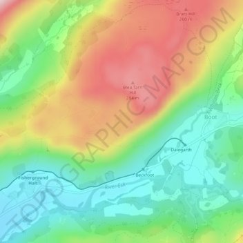
Nombre: Mapa topográfico Blea Tarn, altitud, relieve.
Altitud media: 144 m
Altitud mínima: 23 m
Altitud máxima: 314 m