
Mapa topográfico Silao
Mapa interactivo
Haga clic en el mapa para ver la altitud.
Acerca de este mapa
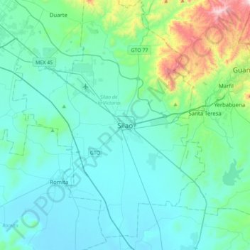
Nombre: Mapa topográfico Silao, altitud, relieve.
Altitud media: 1.877 m
Altitud mínima: 1.735 m
Altitud máxima: 2.705 m
The territory of Silao is almost planar formed in by the Bajío, between its few important elevations, one can find the 'Cerro del Cubilete' whose altitude is 2,570 meters above sea level and is considered the geographic center of the country.