
Haz una donación
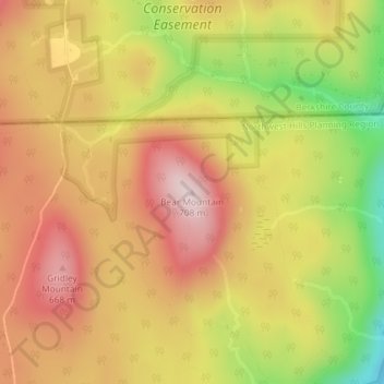
Mapa topográfico Bear Mountain
Haga clic en el mapa para ver la altitud.
Haz una donación
Bear Mountain
Bear Mountain is a peak of the southern Taconic Mountains in Salisbury, Connecticut. At 2,316 feet (706 m) (note, per references 1 and 3, there is disagreement about the precise elevation), Bear Mountain is the highest mountain that lies wholly within Connecticut. However, it is not the state highpoint: in the 1940s, the United States Geological Survey determined that the highest elevation in the state, at 2,380 feet (725 m), was actually on the nearby Connecticut-Massachusetts border, on the southern slope of Massachusetts’ Mount Frissell. There is a stone monument on the Bear Mountain summit. The Appalachian Trail crosses the mountain in a generally north-south direction.
Haz una donación
Acerca de este mapa
Nombre: Mapa topográfico Bear Mountain, altitud, relieve.
Altitud media: 544 m
Altitud mínima: 321 m
Altitud máxima: 701 m
Haz una donación