
Mapa topográfico Kiel
Haga clic en el mapa para ver la altitud.
Acerca de este mapa
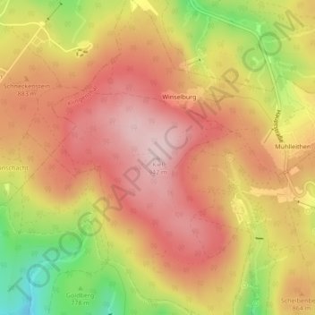
Nombre: Mapa topográfico Kiel, altitud, relieve.
Lugar: Kiel, Klingenthal, Vogtlandkreis, Sachsen, 08248, Deutschland (50.40653 12.46894 50.40663 12.46904)
Altitud media: 843 m
Altitud mínima: 681 m
Altitud máxima: 940 m
Otros mapas topográficos
Haga clic en un mapa para ver su topografía, su altitud y su relieve.