
Mapa topográfico Gemeinde Kössen
Mapa interactivo
Haga clic en el mapa para ver la altitud.
Gemeinde Kössen
Kössen's topography lends itself to air sports in the summer months. The surrounding mountain massifs create great thermals, which are near-perfect for hang gliding and paragliding flights, whilst the valley-floor makes safe landing-grounds, as it is broad, flat and mostly meadow-land; furthermore, the winter ski-lifts allow equal access to the summits in their off-season, for the new market of air-sports adventurers.
Acerca de este mapa
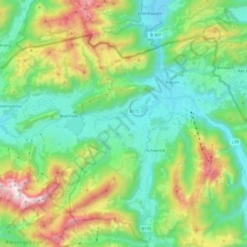
Nombre: Mapa topográfico Gemeinde Kössen, altitud, relieve.
Lugar: Gemeinde Kössen, Bezirk Kitzbühel, Tyrol, 6345, Austria (47.59728 12.31908 47.69638 12.52534)
Altitud media: 979 m
Altitud mínima: 562 m
Altitud máxima: 1.977 m
Otros mapas topográficos
Haga clic en un mapa para ver su topografía, su altitud y su relieve.