
Haz una donación
Mapa topográfico Clarksville
Haga clic en el mapa para ver la altitud.
Haz una donación
Clarksville
Spadra was the first county seat of Johnson County, convenient to steamboat lines. However when stagecoach and train transportation became more common, land routes from Little Rock to Fort Smith were directed along higher elevations through Clarksville. As Clarksville grew, it became the de facto location for the county seat circa 1833, probably due to severe flooding at Spadra. Clarksville was established by survey in November 1836 after Johnson County was formed from part of Pope County. The first court session was held in 1837 in a private building.
Haz una donación
Acerca de este mapa
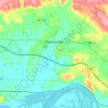
Nombre: Mapa topográfico Clarksville, altitud, relieve.
Lugar: Clarksville, Johnson County, Arkansas, 72830, United States (35.42239 -93.53741 35.49780 -93.41600)
Altitud media: 137 m
Altitud mínima: 102 m
Altitud máxima: 238 m
Haz una donación