
Haz una donación
Mapa topográfico Indian Springs
Haga clic en el mapa para ver la altitud.
Haz una donación
Indian Springs
One year later, Indian Springs was reactivated as Indian Springs Air Force Base by the new United States Air Force, with a new role as a new weapons systems and aircraft research and testing. Among these missions were support for nuclear arms testing at the Nevada Proving Grounds, high-altitude balloon search and retrieval, new gunnery and rocketry systems, and testing of experimental aircraft. For a period of the 1950s and 1960s Indian Springs AFB housed some of the most advanced aircraft and air weapons systems in the world.
Haz una donación
Acerca de este mapa
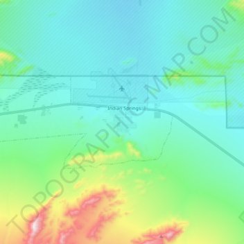
Nombre: Mapa topográfico Indian Springs, altitud, relieve.
Lugar: Indian Springs, Clark County, Nevada, United States (36.54362 -115.80646 36.59616 -115.63600)
Altitud media: 1.078 m
Altitud mínima: 930 m
Altitud máxima: 1.592 m
Haz una donación