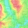
Mapa topográfico Ryton
Haga clic en el mapa para ver la altitud.
Acerca de este mapa

Nombre: Mapa topográfico Ryton, altitud, relieve.
Altitud media: 59 m
Altitud mínima: -2 m
Altitud máxima: 134 m
Otros mapas topográficos
Haga clic en un mapa para ver su topografía, su altitud y su relieve.

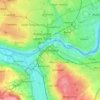
Gateshead
United Kingdom > England > Tyne and Wear > Gateshead
One of the most distinguishing features of Gateshead is its topography. The land rises 230 feet (70 m) from Gateshead Quays to the town centre and continues rising to a height of 525 feet (160 m) at Queen Elizabeth Hospital in Sheriff Hill. This is in contrast to the flat and low lying Team Valley located on…
Altitud media: 62 m