
Mapa topográfico Stanthorpe
Haga clic en el mapa para ver la altitud.
Stanthorpe
Owing to its elevation, Stanthorpe features a subtropical highland climate. At an altitude of 811 metres (2,661 ft), Stanthorpe holds the record for the lowest temperature recorded in Queensland at −10.6 °C (12.9 °F) on 23 June 1961. Sleet and light snowfalls are occasionally recorded, with the most significant snowfall in over 30 years occurring on 17 July 2015.
Acerca de este mapa
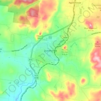
Nombre: Mapa topográfico Stanthorpe, altitud, relieve.
Altitud media: 840 m
Altitud mínima: 760 m
Altitud máxima: 966 m