
Mapa topográfico Offingawier
Mapa interactivo
Haga clic en el mapa para ver la altitud.
Acerca de este mapa
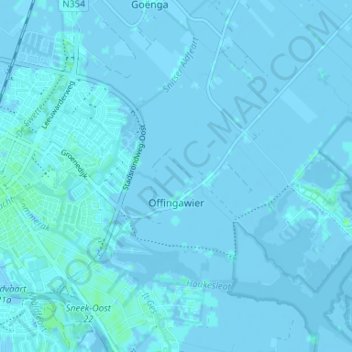
Nombre: Mapa topográfico Offingawier, altitud, relieve.
Lugar: Offingawier, Súdwest-Fryslân, Frisia, Netherlands (53.01544 5.68965 53.05493 5.75543)
Altitud media: 0 m
Altitud mínima: -9 m
Altitud máxima: 5 m
Otros mapas topográficos
Haga clic en un mapa para ver su topografía, su altitud y su relieve.
Vierhuizen
Netherlands > Frisia > Allingawier
Vierhuizen, Allingawier, Súdwest-Fryslân, Frisia, Netherlands, 8758 LG, Netherlands
Altitud media: -2 m
Surhuisterveen
Surhuisterveen, Achtkarspelen, Frisia, Netherlands
Altitud media: 3 m
Oosterstreek
Oosterstreek, Weststellingwerf, Frisia, Netherlands
Altitud media: 4 m
Noardburgum
Netherlands > Frisia > Noardburgum
Noardburgum, Tytsjerksteradiel, Frisia, Netherlands
Altitud media: 1 m
Leeuwarden
Netherlands > Frisia > Leeuwarden
Leeuwarden, Frisia, Netherlands, 8911BR, Netherlands
Altitud media: 0 m