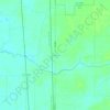
Mapa topográfico Duluth
Haga clic en el mapa para ver la altitud.
Duluth
Duluth's topography is dominated by a steep hillside that climbs from Lake Superior to high inland elevations. Duluth has been called "the San Francisco of the Midwest," alluding to San Francisco's similar water-to-hilltop topography. This similarity was most evident before World War II, when Duluth had a network of streetcars and an inclined railroad, the 7th Avenue West Incline Railway, that, like San Francisco's cable cars, climbed a steep hill. The change in elevation is illustrated by Duluth's two airports. The weather station at the lakeside Sky Harbor Airport on Minnesota Point has an elevation of 607 feet (185 m), while Duluth International Airport, atop the hill, is 820 feet (250 m) higher at 1,427 feet (435 m).
Acerca de este mapa
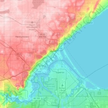
Nombre: Mapa topográfico Duluth, altitud, relieve.
Lugar: Duluth, Saint Louis County, Minnesota, United States (46.64916 -92.30124 46.88057 -91.92018)
Altitud media: 286 m
Altitud mínima: 178 m
Altitud máxima: 458 m
Otros mapas topográficos
Haga clic en un mapa para ver su topografía, su altitud y su relieve.

Tower Junction
United States > Minnesota > Saint Louis County > Breitung Township > Soudan
Altitud media: 437 m