
Gracias por apoyar a este sitio ❤️
Haz una donación
Haz una donación
Mapa topográfico Sheldon Springs
Haga clic en el mapa para ver la altitud.
Gracias por apoyar a este sitio ❤️
Haz una donación
Haz una donación
Sheldon Springs
Sheldon Springs is an unincorporated community village in the town of Sheldon in Franklin County, Vermont, United States. It lies at an altitude of 299 feet (91 m). A post office was established in 1871.
Gracias por apoyar a este sitio ❤️
Haz una donación
Haz una donación
Acerca de este mapa
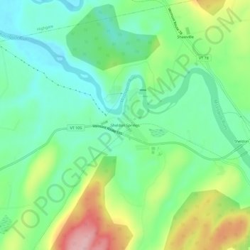
Nombre: Mapa topográfico Sheldon Springs, altitud, relieve.
Altitud media: 118 m
Altitud mínima: 58 m
Altitud máxima: 236 m
Gracias por apoyar a este sitio ❤️
Haz una donación
Haz una donación