
Mapa topográfico Franklin Lake
Mapa interactivo
Haga clic en el mapa para ver la altitud.
Acerca de este mapa
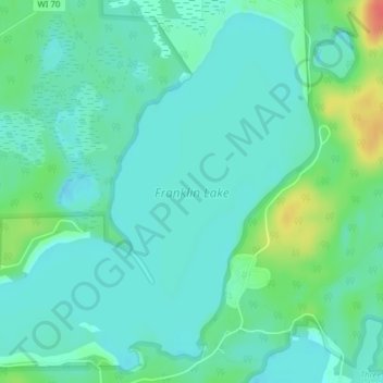
Nombre: Mapa topográfico Franklin Lake, altitud, relieve.
Altitud media: 523 m
Altitud mínima: 510 m
Altitud máxima: 561 m
Otros mapas topográficos
Haga clic en un mapa para ver su topografía, su altitud y su relieve.
Argonne
United States > Wisconsin > Forest County
Argonne, Town of Argonne, Forest County, Wisconsin, 54511, United States
Altitud media: 497 m
Armstrong Creek
United States > Wisconsin > Forest County
Armstrong Creek, Town of Armstrong Creek, Forest County, Wisconsin, 54103, United States
Altitud media: 447 m