
Mapa topográfico Bir
Haga clic en el mapa para ver la altitud.
Bir
The paragliding launch site is in the meadow at Billing (14 km north of Bir), at an elevation of 2400 meters, while the landing site and most tourist accommodations are in the village of Chowgan (also spelled Chaugan), on the southern edge of Bir.
Acerca de este mapa
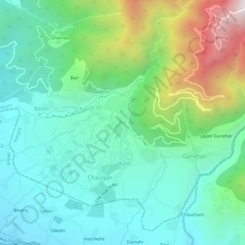
Nombre: Mapa topográfico Bir, altitud, relieve.
Lugar: Bir, Baijnath, Kangra, Himachal Pradesh, 176077, India (32.02452 76.70551 32.06452 76.74551)
Altitud media: 1.628 m
Altitud mínima: 1.284 m
Altitud máxima: 2.560 m