
Gracias por apoyar a este sitio ❤️
Haz una donación
Haz una donación
Mapa topográfico Ramah
Haga clic en el mapa para ver la altitud.
Gracias por apoyar a este sitio ❤️
Haz una donación
Haz una donación
Ramah
Lying at 6,926 feet (2,111 m) above sea level, Ramah is considered by some as a high desert, but at higher elevations it includes tall pines, sandstone cliffs, and timber-covered mountains. Much of the lower landscape in the surrounding area is covered with lava flows from the chain of volcanos to the south.
Gracias por apoyar a este sitio ❤️
Haz una donación
Haz una donación
Acerca de este mapa
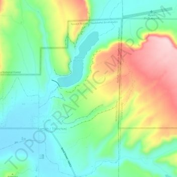
Nombre: Mapa topográfico Ramah, altitud, relieve.
Lugar: Ramah, McKinley County, New Mexico, United States (35.12004 -108.51534 35.16785 -108.46848)
Altitud media: 2.184 m
Altitud mínima: 2.095 m
Altitud máxima: 2.354 m
Gracias por apoyar a este sitio ❤️
Haz una donación
Haz una donación