
Mapa topográfico Ormiston
Mapa interactivo
Haga clic en el mapa para ver la altitud.
Ormiston
Ormiston is a village in East Lothian, Scotland, near Tranent, Humbie, Pencaitland and Cranston, located on the north bank of the River Tyne at an elevation of about 276 feet (84 m).
Acerca de este mapa
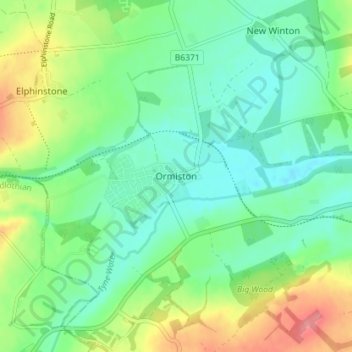
Nombre: Mapa topográfico Ormiston, altitud, relieve.
Lugar: Ormiston, East Lothian, Scotland, EH35 5HN, United Kingdom (55.89285 -2.95984 55.93285 -2.91984)
Altitud media: 102 m
Altitud mínima: 75 m
Altitud máxima: 159 m