
Mapa topográfico Shamirpet mandal
Mapa interactivo
Haga clic en el mapa para ver la altitud.
Acerca de este mapa
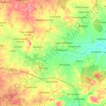
Nombre: Mapa topográfico Shamirpet mandal, altitud, relieve.
Lugar: Shamirpet mandal, Medchal–Malkajgiri, Telangana, 500078, India (17.53637 78.49394 17.69770 78.65615)
Altitud media: 574 m
Altitud mínima: 516 m
Altitud máxima: 642 m
Otros mapas topográficos
Haga clic en un mapa para ver su topografía, su altitud y su relieve.
Laxmidevipally mandal
India > Telangana > Laxmidevipally mandal
Laxmidevipally mandal, Bhadradri Kothagudem, Telangana, 507101, India
Altitud media: 148 m
Secunderabad
India > Telangana > Secunderabad
Secunderabad, Maredpally mandal, Hyderabad, Telangana, 500003, India
Altitud media: 544 m